 TBSD60
 BSD120
 BSD98
BSD98 BSD70
BSD70 BSD60
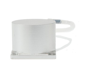
BSD60 BSD50
BSD50 BSD217
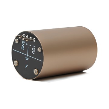
 INS1700
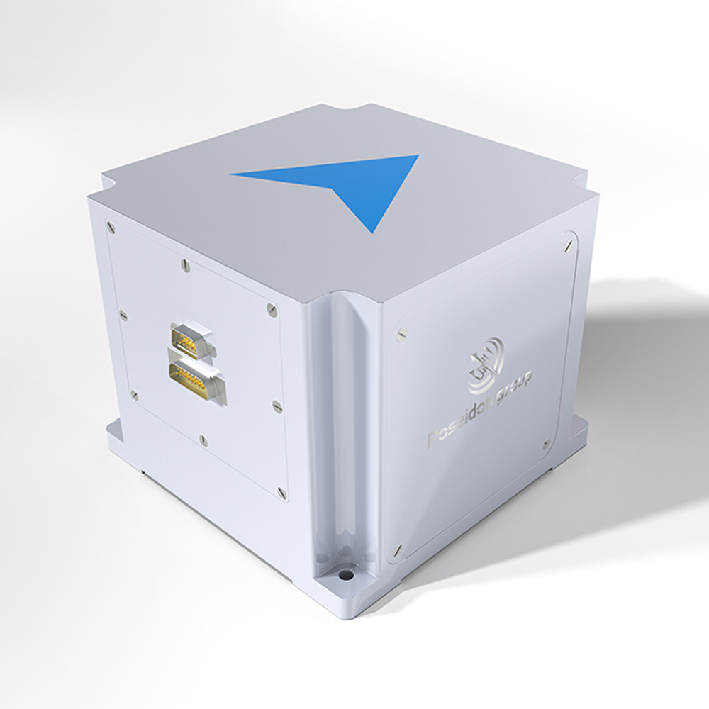
 INS970
 INS570
 INS170
 SLA-4B1L1-65
 SLA-4B1L1-130
 SLA-8B1L1-165
 101 Vessel-mounted Positioning
 102 Acoustic Communication
 103 Tracking and Locating
 104 Diver Navigation System
 105 Intrusion Detection Sonar
 106 Delivery Locator Beacon
 SLLR3000
 SLLR905
 SLLD25
 160M
160M 170M
170M SLFC-70
 SLAF280
 MR360
MR360
Leave Your Message
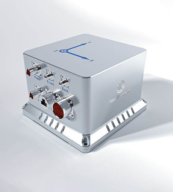
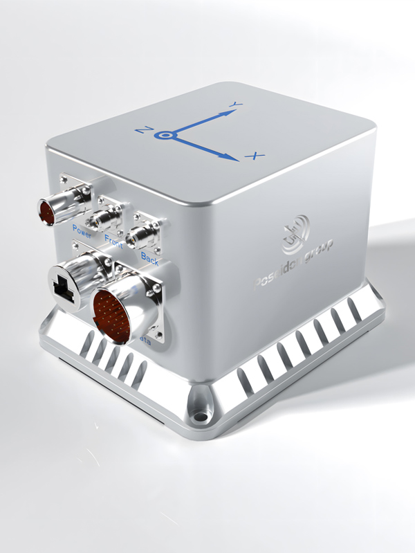
Precision-engineered gyro compass mapping units and fiber optic gyroscope sensors, designed for demanding navigation and mapping applications in Nagoya and worldwide.
Nagoya stands as one of Japan's most strategically significant industrial hubs, home to world-class automotive manufacturers, aerospace integrators, and precision machinery producers. The city's Port of Nagoya — the busiest cargo port in Japan — generates substantial demand for advanced marine navigation instruments, including gyro compass mapping units essential for vessel positioning, harbor logistics, and offshore surveying operations.
With the rapid expansion of autonomous vehicle R&D corridors in the Chubu region, demand for high-accuracy inertial navigation systems and gyro compass mapping units has surged significantly. Major automotive and robotics firms operating in Nagoya's technology parks increasingly rely on fiber optic gyroscope-based mapping units to enable GNSS-independent positioning for autonomous platforms and precision manufacturing robots.
Nagoya's infrastructure modernization programs — including the Linear Chuo Shinkansen project and urban underground utility mapping — further amplify the need for compact, high-precision gyro compass mapping solutions capable of operating in GPS-denied environments.
The gyro compass and inertial navigation sector is undergoing rapid transformation driven by autonomous systems, AI integration, and precision demand across multiple industries.
Japan's maritime industry is accelerating adoption of autonomous vessel technology under the Ministry of Land, Infrastructure, Transport and Tourism's MEGURI2040 initiative. Gyro compass mapping units are central to this transformation, providing reliable heading and attitude data independent of GNSS for port approach, harbor maneuvering, and coastal route planning. Nagoya's port operators are actively integrating these systems into next-generation harbor management platforms.
With Toyota, Denso, and JTEKT headquartered in the Nagoya–Aichi corridor, the region is a global epicenter for autonomous driving development. Fiber optic gyro-based mapping units enable high-frequency inertial measurement for ADAS validation, HD map generation, and real-time localization in urban canyons where GNSS signals are degraded. Demand for miniaturized, high-bandwidth gyro mapping units is growing at over 15% annually in this segment.
Nagoya's aerospace cluster — anchored by Mitsubishi Heavy Industries and Kawasaki Aerospace — requires gyro compass mapping units with aerospace-grade accuracy for UAV attitude control, airborne LiDAR mapping, and satellite attitude determination. The trend toward smaller, lighter, and lower-power FOG-based units is enabling new UAV payload configurations for infrastructure inspection, disaster response, and precision agriculture across Japan's mountainous terrain.
Japan's aging infrastructure and massive underground construction projects — including Nagoya's subway expansions and the Linear Maglev corridor — demand gyro compass mapping units capable of centimeter-level accuracy in GPS-denied tunnels. Strapdown inertial navigation combined with odometry and LiDAR is becoming the standard methodology for utility corridor mapping, structural health monitoring, and precision excavation guidance in Japan's urban underground environment.
Poseidon International Group (Hong Kong) Limited — Connecting the World Through High Accuracy Navigation Technology
Based in Hong Kong, we are a global enterprise dedicated to delivering high-quality products and professional services. We have established long-term, stable, and efficient partnerships with numerous suppliers worldwide, ensuring competitive pricing and superior product quality.
As a trusted gyro compass mapping unit supplier and manufacturer serving clients in Nagoya and across the Asia-Pacific region, Poseidon brings together world-class fiber optic gyroscope engineering, proprietary inertial navigation algorithms, and comprehensive system integration capabilities to meet the most demanding positioning and mapping requirements.
Our products are validated across aviation, aerospace, marine, mining, and railway applications — sectors that are all represented in Nagoya's diverse industrial ecosystem. We serve Nagoya-based clients in automotive R&D, port operations, aerospace manufacturing, and precision surveying with tailored gyro compass mapping solutions backed by responsive technical support.
From component-level innovation to full-system integration, our capabilities ensure gyro compass mapping units of the highest precision and reliability for Nagoya's demanding industries.

Core Component Self-Development
Reducing costs by 25%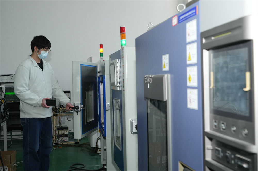
Proprietary System Algorithms
Improving performance by 20%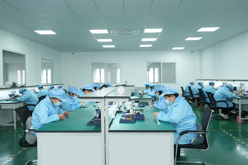
Scalable Mass Production
Ensuring stable quality and efficiencyComprehensive Integration
Delivering cross-industry solutions from components to full systemsPoseidon International Limited, Hong Kong strives to provide satisfactory products and services to customers from all walks of life. As a gyro compass mapping unit supplier serving Nagoya's precision industries, we offer three core service pillars that set us apart:

We provide comprehensive, all-in-one solutions, whether for components, products, systems, or complete project solutions, always ensuring the best value for our clients.

Our experienced team, with deep expertise in international trade, is dedicated to crafting cost-effective solutions tailored to customer needs — including Nagoya-based OEM and system integration partners.

Through close partnerships with leading logistics providers, we guarantee timely and secure deliveries to Nagoya and all major Japanese industrial centers.
Our gyro compass mapping units are engineered to address the specific operational environments and precision requirements of Nagoya's key industries.
Gyro compass mapping units provide reliable heading and roll/pitch data for vessel traffic management, container crane positioning, and autonomous harbor tug operations at Japan's busiest port, where GNSS multipath errors from port infrastructure are significant.
Nagoya's automotive R&D ecosystem demands gyro mapping units for high-frequency inertial measurement during ADAS sensor validation, HD map data collection runs, and real-time vehicle localization in urban test environments across the Aichi prefecture road network.
Precision attitude and heading data from compact gyro compass mapping units enables sub-millimeter positioning for collaborative robots, AGV fleets, and CNC machining centers in Nagoya's world-class automotive component manufacturing facilities.
Fiber optic gyro-based mapping units power autonomous UAV platforms used for inspection of Nagoya's elevated expressways, port crane structures, and industrial chimney stacks — enabling precise geo-referenced data collection without GNSS dependency in cluttered RF environments.
For Nagoya's subway extensions and the Linear Chuo Shinkansen tunnel segments, our gyro compass mapping units provide the backbone of strapdown inertial survey systems, delivering accurate 3D trajectory data in GPS-denied underground environments.
Nagoya's aerospace cluster relies on high-grade gyro compass mapping units for inertial reference systems in aircraft flight test instrumentation, UAV autopilot platforms, and satellite attitude control subsystems developed by regional aerospace integrators.
Our commitment to innovation drives continuous advancement in gyro compass mapping unit performance, reliability, and integration capability.

We specialize in the independent research, design, and production of fiber optic gyroscopes (FOG), inertial navigation systems (INS), attitude and control systems, autonomous driving systems, and intelligent control systems for unmanned equipment. By integrating industry-specific requirements, we have made significant technological advancements in digitalization, automation, and intelligence, securing multiple technical patents. With years of experience, we have evolved into a multi-industry intelligent solutions provider with a portfolio of proprietary core technologies.
Our core team comprises seasoned experts with extensive backgrounds in aerospace and inertial navigation. We have successfully tackled critical technological challenges in high-precision GNSS-free navigation, laser measurement, integrated navigation, multi-source data fusion, and precise positioning — areas that were once bottlenecks in the industry. This expertise directly benefits Nagoya clients requiring gyro compass mapping units for GPS-denied industrial environments.


Our products are smaller in size, higher in accuracy, and more stable in performance, featuring long-term dynamic auto-calibration with zero-drift operation. They are widely adopted in scientific research, industrial control, intelligent unmanned systems, high-precision detection, and metrology. Having passed rigorous validation in aviation, aerospace, marine, mining, and railway applications, our solutions have been procured in bulk, filling key technological gaps in precision navigation.
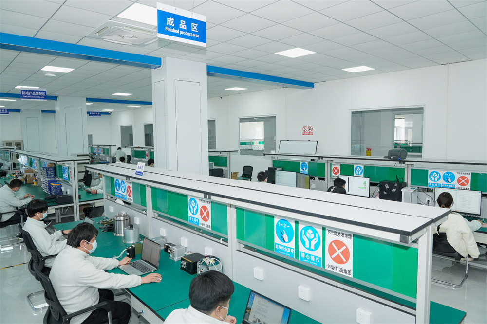
We operate over 6,000-square-meter manufacturing facility in mainland China, equipped with advanced R&D, production, and testing infrastructure, enabling large-scale production and timely delivery. Our network of subsidiaries, offices, and spare parts warehouses across China ensures prompt technical support and after-sales service for Nagoya-based procurement teams and system integrators.
Compared to similar gyro compass mapping unit suppliers, we offer unique advantages that make us the preferred partner for Nagoya's precision industries.

Creating mutually beneficial relationships with clients and partners — ensuring long-term value for Nagoya's procurement and engineering teams.

Commitment to ethical business practices and transparent communication throughout every gyro compass mapping unit project lifecycle.

Providing clear, one-time offers with no hidden costs — straightforward quotations for gyro compass mapping units, systems, and integration services.

24/7 service guarantee in all time zones with minimal response time — critical for Nagoya clients operating across Japan-standard and international business hours.
Guided by the vision of "Connecting the World through Inertial Navigation", we strive to push the boundaries of navigation technology, aiming to become a leading integrated solutions provider with a broad product portfolio and advanced competencies. Partner with us for your gyro compass mapping unit requirements in Nagoya and across Japan.
Contact Us!Explore our full range of gyro compass mapping units, fiber optic gyroscopes, and integrated navigation systems for Nagoya's marine, industrial, and autonomous applications.


